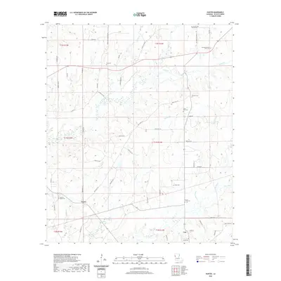
2020 Map of Hunter
USGS Topo · Published 2020About this map
Hunter and Lula serve as the primary settlement points in this pocket of DeSoto Parish, where a dense network of parish roads and winding bayous dictates the local geography. The landscape is heavily marked by its spiritual and genealogical heritage, featuring numerous country churches and burial grounds such as Magnolia Church, Beulah Church, and Morning Glory Church. The drainage pattern is defined by the slow-moving waters of Cypress Bayou, Bull Bayou, and Cow Bayou, which carve through the terrain alongside local landmarks like Cedar Hill. This survey provides a modern view of rural land divisions and the enduring placement of family-named cemeteries, including Prude Cem, Ebenezer Cem, and Shady Grove Cem, which remain essential touchstones for tracing family roots in this corner of Louisiana.
Find a feature on this map
65 named features on this map. Tap any name to fly to it.
Don’t see what you’re looking for? This feature index may not catch every label — zoom into the map to look around manually.
Map Details
Editions of this 2020 Hunter Map
This is the sole edition of this map. No revisions or reprints were ever made.
Other maps of this area

1941 · Pelican
USGS Topo · 1:62,500

1943 · Pleasant Hill
USGS Topo · 1:62,500

1944 · Logansport
USGS Topo · 1:62,500

1944 · Pleasant Hill
USGS Topo · 1:62,500

1945 · Grand Cane
USGS Topo · 1:62,500

1945 · Mansfield
USGS Topo · 1:62,500

1947 · Mansfield
USGS Topo · 1:62,500

1953 · Alexandria
USGS Topo · 1:250,000

1955 · Shreveport
USGS Topo · 1:250,000

1955 · Alexandria
USGS Topo · 1:250,000