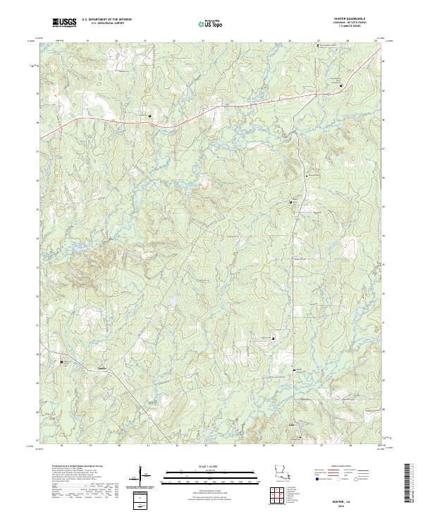
2024 Map of Hunter
USGS Topo · Published 2024About this map
Hunter and Lula anchor the southern reaches of this De Soto Parish landscape, where family history is deeply etched into the countryside through a dense network of churches and burial grounds. The map reveals a community structured around rural centers like Magnolia Church and Beulah Church, each with their namesake cemeteries. Genealogists will find particular value in the scattered locations of smaller plots such as Prude Cem, Ebenezer Cem, and Pollard Cem, which often represent the earliest established families in this part of Louisiana.
Find a feature on this map
69 named features on this map. Tap any name to fly to it.
Don’t see what you’re looking for? This feature index may not catch every label — zoom into the map to look around manually.
Map Details
Editions of this 2024 Hunter Map
This is the sole edition of this map. No revisions or reprints were ever made.
Other maps of this area

1941 · Pelican
USGS Topo · 1:62,500

1943 · Pleasant Hill
USGS Topo · 1:62,500

1944 · Logansport
USGS Topo · 1:62,500

1944 · Pleasant Hill
USGS Topo · 1:62,500

1945 · Grand Cane
USGS Topo · 1:62,500

1945 · Mansfield
USGS Topo · 1:62,500

1947 · Mansfield
USGS Topo · 1:62,500

1953 · Alexandria
USGS Topo · 1:250,000

1955 · Shreveport
USGS Topo · 1:250,000

1955 · Alexandria
USGS Topo · 1:250,000