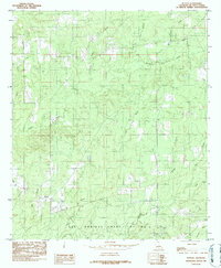
1984 Map of Hunter
USGS Topo · Published 1984About this map
Las Ormigas Grant Lot No 4 anchors the southern landscape of this De Soto Parish survey, showcasing a complex network of waterways that defined land use in the mid-1980s. The small settlements of Hunter and Lula are positioned near the western and southern margins, respectively, connected by a system of unimproved roads and trails. Evidence of former transportation infrastructure appears in the north with the Old RR Grade, tracing a path near Clemar Creek and Baget Creek.
Find a feature on this map
19 named features on this map. Tap any name to fly to it.
Don’t see what you’re looking for? This feature index may not catch every label — zoom into the map to look around manually.
Map Details
Editions of this 1984 Hunter Map
This is the sole edition of this map. No revisions or reprints were ever made.
Other maps of this area

1941 · Pelican
USGS Topo · 1:62,500

1943 · Pleasant Hill
USGS Topo · 1:62,500

1944 · Logansport
USGS Topo · 1:62,500

1944 · Pleasant Hill
USGS Topo · 1:62,500

1945 · Grand Cane
USGS Topo · 1:62,500

1945 · Mansfield
USGS Topo · 1:62,500

1947 · Mansfield
USGS Topo · 1:62,500

1953 · Alexandria
USGS Topo · 1:250,000

1955 · Shreveport
USGS Topo · 1:250,000

1955 · Alexandria
USGS Topo · 1:250,000