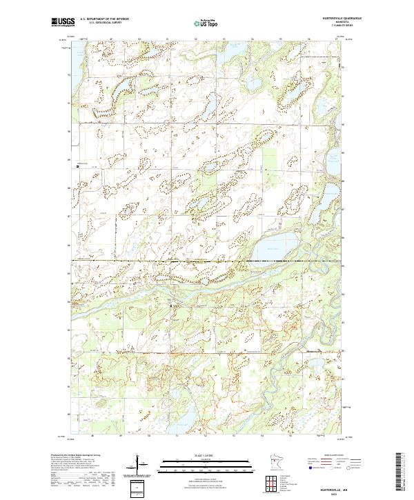
2022 Map of Huntersville
USGS Topo · Published 2022About this map
Huntersville sits at the confluence of wood and water in this 2022 survey, where the Shell River joins the Crow Wing River. This north-central Minnesota landscape is defined by its glacial hydrology, featuring numerous named water bodies from Big Stony Lake in the north to the more secluded Finn Lake in the south. The settlement patterns of Hubbard and Wadena counties are preserved through features like the Hubbard Cem and Shell City Cem, which anchor the map with local history. The area is heavily geared toward outdoor recreation and forest management, as evidenced by the dense network of Huntersville Horse Trails Trl and the presence of Huntersville Forest Rd. The survey also highlights the winding path of Shell City Dr, tracing the riverside where industry and early settlement once converged.
Find a feature on this map
43 named features on this map. Tap any name to fly to it.
Don’t see what you’re looking for? This feature index may not catch every label — zoom into the map to look around manually.
Map Details
Editions of this 2022 Huntersville Map
This is the sole edition of this map. No revisions or reprints were ever made.
Other maps of this area

1953 · Brainerd
USGS Topo · 1:250,000

1957 · Brainerd
USGS Topo · 1:250,000

1958 · Brainerd
USGS Topo · 1:250,000

1965 · Brainerd
USGS Topo · 1:250,000

1969 · Park Rapids
USGS Topo · 1:24,000

1969 · Menahga
USGS Topo · 1:24,000

1969 · Sebeka
USGS Topo · 1:24,000
1969 · Nimrod
USGS Topo · 1:24,000

1969 · Burgen Lake
USGS Topo · 1:24,000

1970 · Nevis
USGS Topo · 1:24,000