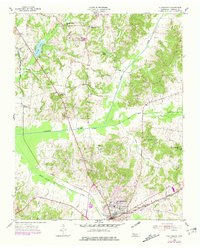
1955 Map of Huntingdon
USGS Topo · Published 1981About this map
Huntingdon serves as the focal point of this West Tennessee landscape, where the Louisville and Nashville railroad corridor anchors the local economy and settlement pattern. The area is defined by a dense network of country churches and family burial grounds, such as St Pauls Ch and the Gordon Cem, which reflect the region's deep genealogical roots. Water management is a visible priority across the terrain, evidenced by the Crooked Creek Drainage Canal and Beaver Drainage Canal, engineered to facilitate agriculture in the low-lying bottoms.
Find a feature on this map
35 named features on this map. Tap any name to fly to it.
Don’t see what you’re looking for? This feature index may not catch every label — zoom into the map to look around manually.
Map Details
Editions of this 1955 Huntingdon Map
3 editions found
Other maps of this area

1936 · Mansfield
USGS Topo · 1:24,000

1936 · Vale
USGS Topo · 1:24,000

1936 · Center Ridge
USGS Topo · 1:24,000

1936 · Buena Vista
USGS Topo · 1:24,000

1950 · Palmer Shelter
USGS Topo · 1:24,000

1950 · Vale
USGS Topo · 1:24,000
1950 · Buena Vista
USGS Topo · 1:24,000

1950 · Mansfield
USGS Topo · 1:24,000

1955 · Henry
USGS Topo · 1:24,000

1955 · Huntingdon
USGS Topo · 1:24,000