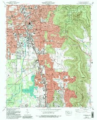
1975 Map of Huntsville
USGS Topo · Published 1993About this map
Huntsville is depicted here during a period of substantial mid-century growth, as urban development pushes south into Jones Valley and eastward toward the foothills of Monte Sano Mountain. The map illustrates a city defined by both its early origins at Huntsville Spring Branch and its newer role in the space-age defense sector, with the expansive Redstone Arsenal boundary forming a stark southern limit to civilian expansion. Residential neighborhoods such as Darwin Downs, Five Points, and Flemington Heights are interspersed with numerous institutional landmarks, including Oakwood College and the Huntsville Depot. The rugged topography of Green Mountain and Huntsville Mountain creates a natural corridor, preserved in part by Monte Sano State Park. Along the western edge, the influence of the Tennessee Valley is visible at the Wheeler National Wildlife Refuge and the broad waters of Byrd Spring Lake.
Find a feature on this map
144 named features on this map. Tap any name to fly to it.
Don’t see what you’re looking for? This feature index may not catch every label — zoom into the map to look around manually.
Map Details
Editions of this 1975 Huntsville Map
3 editions found
Other maps of this area

1888 · Scottsboro
USGS Topo · 1:125,000

1888 · Huntsville
USGS Topo · 1:125,000

1892 · Huntsville
USGS Topo · 1:125,000

1892 · Scottsboro
USGS Topo · 1:125,000

1936 · Jeff
USGS Topo · 1:24,000

1936 · Triana
USGS Topo · 1:24,000

1936 · New Hope
USGS Topo · 1:24,000

1936 · Madison
USGS Topo · 1:24,000

1936 · Meridianville
USGS Topo · 1:24,000

1936 · Moontown
USGS Topo · 1:24,000