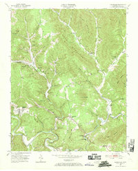
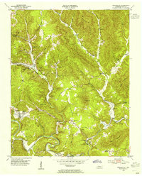
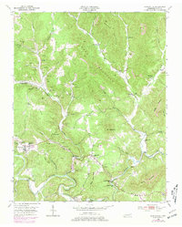
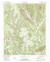
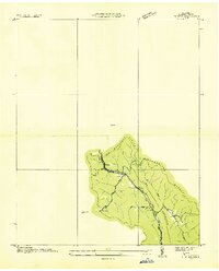
1953 Map of Huntsville
USGS Topo · Published 1969About this map
Huntsville serves as the central hub of this mid-century portrait of Scott County, where the topography of Shug Mountain and Ditney Mtn dictates the flow of human settlement. The landscape is defined by the heavy presence of resource extraction, with numerous Strip Mines and active workings scattered throughout the valleys of Paint Rock Creek and Buffalo Creek. This industrial footprint exists alongside a deeply rooted rural infrastructure of small community centers like Almy, Newtown, and Winona.
Find a feature on this map
66 named features on this map. Tap any name to fly to it.
Don’t see what you’re looking for? This feature index may not catch every label — zoom into the map to look around manually.
Map Details
Editions of this 1953 Huntsville Map
4 editions found
Other maps of this area

1890 · Williamsburg
USGS Topo · 1:125,000

1893 · Briceville
USGS Topo · 1:125,000

1894 · Williamsburg
USGS Topo · 1:125,000

1895 · Wartburg
USGS Topo · 1:125,000

1895 · Briceville
USGS Topo · 1:125,000

1896 · Wartburg
USGS Topo · 1:125,000

1896 · Briceville
USGS Topo · 1:125,000

1934 · Barthell
USGS Topo · 1:62,500
1936 · Block
USGS Topo · 1:24,000
1936 · Pioneer
USGS Topo · 1:24,000