
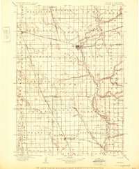
1898 Map of Huron
USGS Topo · Published 1898About this map
The James River carves a winding path through this central South Dakota landscape, serving as a geographic anchor for the region's early development. Significant rail activity radiates from Huron, a major junction point where the Chicago and Northwestern meets the Great Northern and the Chicago Minnesota and Central Dakota Line. These iron arteries transformed the prairie, supporting established settlements like Woonsocket and Wolsey.
Find a feature on this map
60 named features on this map. Tap any name to fly to it.
Don’t see what you’re looking for? This feature index may not catch every label — zoom into the map to look around manually.
Map Details
Editions of this 1898 Huron Map
2 editions found
Other maps of this area

1895 · Byron
USGS Topo · 1:125,000

1899 · Mitchell
USGS Topo · 1:125,000

1899 · Alexandria
USGS Topo · 1:125,000

1899 · Redfield
USGS Topo · 1:125,000

1899 · De Smet
USGS Topo · 1:125,000

1942 · Crow Lake
USGS Topo · 1:62,500

1950 · Wessington NE
USGS Topo · 1:24,000

1951 · Wessington SE
USGS Topo · 1:24,000

1953 · Huron
USGS Topo · 1:250,000

1953 · Watertown
USGS Topo · 1:250,000