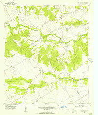
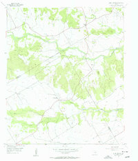
1956 Map of Hurst Spring
USGS Topo · Published 1956About this map
Neils Creek and Hog Creek wind through this mid-century landscape along the Bosque Co / Coryell Co line. The area is characterized by a network of rural roads connecting small settlements like Hurst and the Crossroad Store. Local history and genealogy are anchored by several burial grounds, including Norway Mill Cemetery and Post Oak Cemetery, alongside markers of earlier community life such as the Hurst Spring Sch (Aband). Significant landmarks like Norman Hill and Norway Hill provide vertical relief in an area primarily defined by ranching and agriculture. Notable industrial features from this period include a Caliche Pit and the Old Norway Mill, suggesting a transition from traditional water-powered milling to modern resource extraction by the mid-1950s.
Find a feature on this map
23 named features on this map. Tap any name to fly to it.
Don’t see what you’re looking for? This feature index may not catch every label — zoom into the map to look around manually.
Map Details
Editions of this 1956 Hurst Spring Map
2 editions found
Other maps of this area

1888 · Meridian
USGS Topo · 1:125,000

1894 · Meridian
USGS Topo · 1:125,000

1954 · Waco
USGS Topo · 1:250,000

1955 · Waco
USGS Topo · 1:250,000

1955 · Clifton
USGS Topo · 1:24,000
1955 · Turnersville
USGS Topo · 1:24,000
1955 · Ater
USGS Topo · 1:24,000
1955 · Coryell
USGS Topo · 1:24,000
1956 · Hurst Spring
USGS Topo · 1:24,000

1956 · Cranfills Gap
USGS Topo · 1:24,000