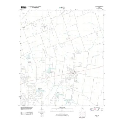
2010 Map of Hutto
USGS Topo · Published 2010About this map
Hutto serves as the focal point of this Williamson County landscape, showing the town's footprint as it appeared in the early 21st century. The map reveals a transition from traditional agricultural lands, represented by Bell Gin in the northwest, to a community increasingly defined by water management and suburban growth. A sophisticated network of water infrastructure is evident, with multiple Soil Conservation Service projects including the Soil Conservation Service Site 18 Reservoir and Soil Conservation Service Site 21 Reservoir scattered along the local drainage basins. The terrain is shaped by numerous waterways such as Brushy Creek, Cottonwood Creek, and the various forks of Mustang Creek, while Windmill Ridge rises to the north. This survey provides a clear view of the county road system and the central Hutto Post Office, documenting the intersection of historic settlement and modern infrastructure.
Find a feature on this map
65 named features on this map. Tap any name to fly to it.
Don’t see what you’re looking for? This feature index may not catch every label — zoom into the map to look around manually.
Map Details
Editions of this 2010 Hutto Map
This is the sole edition of this map. No revisions or reprints were ever made.
Other maps of this area

1885 · Taylor
USGS Topo · 1:125,000

1885 · Bastrop
USGS Topo · 1:125,000

1887 · Taylor
USGS Topo · 1:125,000

1893 · Georgetown
USGS Topo · 1:125,000

1893 · Bastrop
USGS Topo · 1:125,000

1894 · Taylor
USGS Topo · 1:125,000

1896 · Austin
USGS Topo · 1:125,000

1897 · Austin
USGS Topo · 1:125,000

1904 · Bastrop
USGS Topo · 1:125,000

1910 · Austin
USGS Topo · 1:125,000