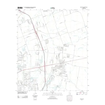
2013 Map of Hutto
USGS Topo · Published 2013About this map
Hutto serves as the central hub of this Williamson County landscape, showing a suburbanizing environment defined by a dense network of residential streets and arterial roads like University Blvd and Limmer Loop. The area is characterized by the convergence of multiple waterways, including Brushy Creek and Cottonwood Creek, which are supplemented by several managed water features such as Soil Conservation Service Site 19 Reservoir. The agricultural roots of the region are still visible at Bell Gin in the northwest, while the transition to modern residential developments is evident in neighborhoods like Cross Country Estates. This survey provides a look at the infrastructure of the early 21st century, from the local Post Office in the center of Hutto to the network of county roads like Co Rd 110 and Co Rd 160 that link these expanding communities.
Find a feature on this map
171 named features on this map. Tap any name to fly to it.
Don’t see what you’re looking for? This feature index may not catch every label — zoom into the map to look around manually.
Map Details
Editions of this 2013 Hutto Map
This is the sole edition of this map. No revisions or reprints were ever made.
Other maps of this area

1885 · Taylor
USGS Topo · 1:125,000

1885 · Bastrop
USGS Topo · 1:125,000

1887 · Taylor
USGS Topo · 1:125,000

1893 · Georgetown
USGS Topo · 1:125,000

1893 · Bastrop
USGS Topo · 1:125,000

1894 · Taylor
USGS Topo · 1:125,000

1896 · Austin
USGS Topo · 1:125,000

1897 · Austin
USGS Topo · 1:125,000

1904 · Bastrop
USGS Topo · 1:125,000

1910 · Austin
USGS Topo · 1:125,000