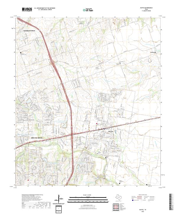
2022 Map of Hutto
USGS Topo · Published 2022About this map
Hutto and the surrounding Williamson County prairie are defined by a complex network of waterways and early burial grounds in this modern topographic record. The landscape is drained by the meandering courses of Brushy Cr, Mustang Cr, and Cottonwood Cr, while a series of modern infrastructure projects like the Soil Conservation Service Site 18 Reservoir manage the region's hydrology. For genealogists and local historians, the map is an essential reference, documenting several small community cemeteries including the Santa Maria Cem, the Shiloh-McCutcheon Cem, and the Evangelical Free Church Cem. The settlement patterns here show the expansion of Georgetown and Round Rock toward the older farming communities, such as Taylor, connected by an increasingly dense grid of county roads and the TX 130 SVC RD corridor.
Find a feature on this map
58 named features on this map. Tap any name to fly to it.
Don’t see what you’re looking for? This feature index may not catch every label — zoom into the map to look around manually.
Map Details
Editions of this 2022 Hutto Map
This is the sole edition of this map. No revisions or reprints were ever made.
Other maps of this area

1885 · Taylor
USGS Topo · 1:125,000

1885 · Bastrop
USGS Topo · 1:125,000

1887 · Taylor
USGS Topo · 1:125,000

1893 · Georgetown
USGS Topo · 1:125,000

1893 · Bastrop
USGS Topo · 1:125,000

1894 · Taylor
USGS Topo · 1:125,000

1896 · Austin
USGS Topo · 1:125,000

1897 · Austin
USGS Topo · 1:125,000

1904 · Bastrop
USGS Topo · 1:125,000

1910 · Austin
USGS Topo · 1:125,000