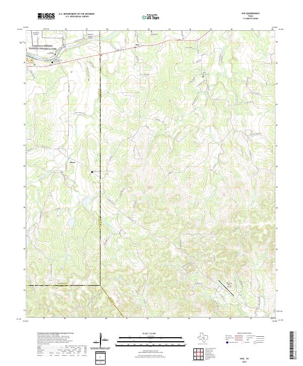
2022 Map of Hye
USGS Topo · Published 2022About this map
Lyndon B Johnson National Historical Park anchors the northwestern corner of this map along the Pedernales River, a landscape deeply tied to the 36th President's legacy. This Hill Country terrain is defined by the convergence of Gillespie, Blanco, and Kendall counties, where ranching heritage remains evident in the numerous private airfields like LBJ Ranch Airport and Hye Airport. The settlement of Hye and the community at Albert serve as historic nodes in an area of winding roads and seasonal drainages, including Williams Cr and W Fork Rocky Cr. Local genealogy is well-preserved through family and community landmarks such as the Johnson Family Cem, Wilke Cem, and the Trinity Lutheran Church Cem. The topography is marked by notable elevations like Coyote Ridge and Riker Rock Hill, illustrating the transition from river bottomlands to the limestone uplands characteristic of this part of Texas.
Find a feature on this map
84 named features on this map. Tap any name to fly to it.
Don’t see what you’re looking for? This feature index may not catch every label — zoom into the map to look around manually.
Map Details
Editions of this 2022 Hye Map
This is the sole edition of this map. No revisions or reprints were ever made.
Other maps of this area

1887 · Blanco
USGS Topo · 1:125,000

1894 · Fredericksburg
USGS Topo · 1:125,000

1894 · Blanco
USGS Topo · 1:125,000

1954 · Llano
USGS Topo · 1:250,000

1955 · Llano
USGS Topo · 1:250,000

1956 · Llano
USGS Topo · 1:250,000

1961 · Stonewall
USGS Topo · 1:24,000

1961 · Hye
USGS Topo · 1:24,000

1961 · Cave Creek School
USGS Topo · 1:24,000

1961 · Rocky Creek
USGS Topo · 1:24,000