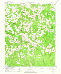
1963 Map of Hylas
USGS Topo · Published 1965About this map
The South Anna River flows across the northern edge of this landscape where the boundaries of Hanover, Goochland, and Henrico counties meet. Rural life in the early 1960s is centered around small crossroads communities like Rockville, Johnsons Springs, and Hylas. The map reveals a high density of country churches, including Berea Ch, Goochland Ch, and St Matthews Ch, alongside local landmarks such as the Rockville Sch.
Find a feature on this map
34 named features on this map. Tap any name to fly to it.
Don’t see what you’re looking for? This feature index may not catch every label — zoom into the map to look around manually.
Map Details
Editions of this 1963 Hylas Map
3 editions found
Other maps of this area

1890 · Goochland
USGS Topo · 1:125,000

1892 · Goochland
USGS Topo · 1:125,000

1936 · Richmond West
USGS Topo · 1:24,000

1936 · Glen Allen
USGS Topo · 1:24,000

1941 · Glen Allen
USGS Topo · 1:31,680

1942 · Westhampton
USGS Topo · 1:31,680

1943 · Mabelton
USGS Topo · 1:31,680

1943 · Fine Creek Mills
USGS Topo · 1:31,680
1943 · Hanover Academy
USGS Topo · 1:31,680

1943 · Perkinsville
USGS Topo · 1:31,680