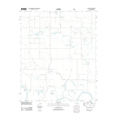
2012 Map of Idabel SE
USGS Topo · Published 2012About this map
The Red River serves as the prominent natural boundary in this landscape on the Oklahoma-Texas border, defined by the winding hydrology of its floodplain. The area is characterized by numerous oxbow lakes and sloughs, remnants of the river's shifting course, such as Eagle Bend Lake, Old River Lake, and Mintubbe Lake. Further north, the terrain transitions into a more managed water system, featuring a series of reservoirs including Waterfall-Gilford Creeks Site 5 Reservoir and Waterfall-Gilford Creeks Site 7 Reservoir. These structures, along with the channelization seen at the Bryarly Cut-off, illustrate the ongoing human efforts to control the drainage of the Waterfall Creek and Mud Creek basins. Local infrastructure is represented by the north-south corridor of Us HWY 259, providing access to this rural landscape of wetlands and water management sites.
Find a feature on this map
29 named features on this map. Tap any name to fly to it.
Don’t see what you’re looking for? This feature index may not catch every label — zoom into the map to look around manually.
Map Details
Editions of this 2012 Idabel SE Map
This is the sole edition of this map. No revisions or reprints were ever made.
Other maps of this area

1950 · Idabel
USGS Topo · 1:24,000

1950 · Acworth
USGS Topo · 1:24,000

1950 · De Kalb NW
USGS Topo · 1:24,000

1950 · White Rock
USGS Topo · 1:24,000

1950 · Shults
USGS Topo · 1:24,000

1950 · Haworth
USGS Topo · 1:24,000

1951 · Idabel
USGS Topo · 1:24,000

1951 · Garvin
USGS Topo · 1:24,000

1951 · Idabel SE
USGS Topo · 1:24,000

1951 · English
USGS Topo · 1:24,000