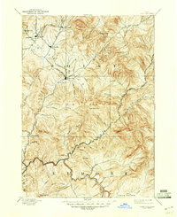
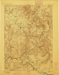
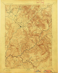
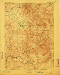
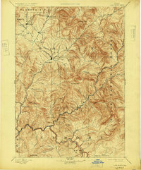
1894 Map of Idaho City
USGS Topo · Published 1947About this map
Idaho City serves as the focal point of this late 19th-century topographic study, which captures the Boise Basin during a significant era of gold mining and mountain settlement. The map traces the intricate drainage systems that defined early Idaho development, including Grimes Creek, Moore Creek, and Elk Creek. A string of historic mining camps and settlements—Quartzburg, Placerville, Pioneerville, and Centerville—occupies the northwestern quadrant, connected by early trails and rugged gulches like Boyles Gulch and Slaughter House Gulch.
Find a feature on this map
56 named features on this map. Tap any name to fly to it.
Don’t see what you’re looking for? This feature index may not catch every label — zoom into the map to look around manually.
Map Details
Editions of this 1894 Idaho City Map
7 editions found

Other maps of this area

1891 · Bear Valley
USGS Topo · 1:125,000

1892 · Mountain Home
USGS Topo · 1:125,000

1892 · Boise
USGS Topo · 1:125,000

1892 · Bisuka
USGS Topo · 1:125,000

1892 · Camas Prairie
USGS Topo · 1:125,000

1893 · Mountain Home
USGS Topo · 1:125,000

1893 · Bear Valley
USGS Topo · 1:125,000

1893 · Camas Prairie
USGS Topo · 1:125,000

1894 · Bisuka
USGS Topo · 1:125,000

1894 · Squaw Creek
USGS Topo · 1:125,000