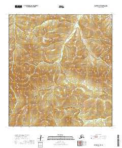
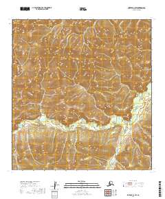
2019 Map of Iditarod B-2 NW
USGS Topo · Published 2019About this map
The Kuskokwim Mountains dominate the interior landscape of this region, shaping a complex drainage network that defines the local geography. Several named waterways weave through the high ground, including the Little Waldren Fork which traverses the central portion of the quadrangle. Smaller tributaries like Homestake Cr and Granite Cr feed into the larger river systems, illustrating the primitive, unpopulated character of this part of the Alaska interior. The absence of roads or established settlements on the 2019 survey emphasizes the isolation of the terrain, where the natural hydrology of the Little E Fork and its surrounding peaks remains the primary focal point for navigation and land use.
Find a feature on this map
14 named features on this map. Tap any name to fly to it.
Don’t see what you’re looking for? This feature index may not catch every label — zoom into the map to look around manually.
Map Details
Editions of this 2019 Iditarod B-2 NW Map
This is the sole edition of this map. No revisions or reprints were ever made.
Other maps of this area

1951 · Iditarod
USGS Topo · 1:250,000

1954 · Iditarod B-2
USGS Topo · 1:63,360

1954 · Iditarod C-3
USGS Topo · 1:63,360

1954 · Iditarod B-3
USGS Topo · 1:63,360

1954 · Iditarod C-2
USGS Topo · 1:63,360

1956 · Iditarod
USGS Topo · 1:250,000
2019 · Iditarod B-3 SE
USGS Topo · 1:25,000
2019 · Iditarod C-3 SE
USGS Topo · 1:25,000
2019 · Iditarod B-3 NE
USGS Topo · 1:25,000
2019 · Iditarod C-2 SW
USGS Topo · 1:25,000