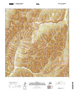
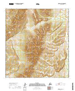
2019 Map of Iditarod C-4 SE
USGS Topo · Published 2019About this map
The Kuskokwim Mountains dominate the interior landscape of this region, shaping the complex drainage patterns of the western Alaskan wilderness. The map documents a rugged watershed where the Dishna River flows along the eastern margin, fed by a network of tributaries including Otter Cr and its distinct branches. The divergence of the N Fork Otter Cr and the S Fork Otter Cr across the central terrain illustrates the geographical isolation of the Yukon-Koyukuk Census Area. This survey provides an essential look at the drainage systems of the Alder Cr basin before further environmental shifts or topographic changes. The absence of roads or permanent structures reflects the primitive state of the land, preserving the natural hydrological and geological features of the subarctic interior.
Find a feature on this map
11 named features on this map. Tap any name to fly to it.
Don’t see what you’re looking for? This feature index may not catch every label — zoom into the map to look around manually.
Map Details
Editions of this 2019 Iditarod C-4 SE Map
This is the sole edition of this map. No revisions or reprints were ever made.
Other maps of this area

1951 · Iditarod
USGS Topo · 1:250,000

1954 · Iditarod C-4
USGS Topo · 1:63,360

1954 · Iditarod C-3
USGS Topo · 1:63,360

1954 · Iditarod B-3
USGS Topo · 1:63,360

1954 · Iditarod B-4
USGS Topo · 1:63,360

1956 · Iditarod
USGS Topo · 1:250,000
2019 · Iditarod C-3 NW
USGS Topo · 1:25,000
2019 · Iditarod B-4 NW
USGS Topo · 1:25,000
2019 · Iditarod B-3 NW
USGS Topo · 1:25,000
2019 · Iditarod C-4 NE
USGS Topo · 1:25,000