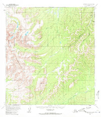
1954 Map of Iditarod D-2
USGS Topo · Published 1972About this map
Beaver Mountains dominate the western portion of this mid-century Alaskan interior landscape, where the seasonal movement of people is marked by designated Summer Trail and Winter Trail routes. The drainage patterns here are complex, with the Beaver Creek system and Ganes Creek carving through the high terrain. Human activity is concentrated along these watercourses, notably at the Ganes Creek & Landing Strip in the northeast corner. This area highlights the importance of aviation and hydraulic extraction in the remote interior, specifically indicated by a Placer Mine near Six Gulch. Further south, Crater Mtn stands as a prominent landmark above Lincoln Creek. The presence of an isolated Cabin and various named tributaries like Fourth of July Creek and Last Chance Creek reflects a landscape defined by prospecting and the rugged logistics of the era.
Find a feature on this map
15 named features on this map. Tap any name to fly to it.
Don’t see what you’re looking for? This feature index may not catch every label — zoom into the map to look around manually.
Map Details
Editions of this 1954 Iditarod D-2 Map
2 editions found
Other maps of this area

1951 · Ophir
USGS Topo · 1:250,000

1951 · Iditarod
USGS Topo · 1:250,000

1954 · Ophir A-2
USGS Topo · 1:63,360

1954 · Ophir A-1
USGS Topo · 1:63,360

1954 · Iditarod C-3
USGS Topo · 1:63,360

1954 · Iditarod C-2
USGS Topo · 1:63,360

1954 · Iditarod D-2
USGS Topo · 1:63,360

1954 · Ophir A-3
USGS Topo · 1:63,360

1954 · Iditarod D-3
USGS Topo · 1:63,360

1954 · Ophir
USGS Topo · 1:250,000