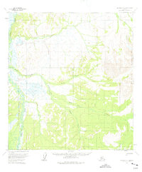
1954 Map of Iditarod D-3
USGS Topo · Published 1975About this map
The Dishna River meanders through a landscape of wetlands and interior wilderness, as documented in this mid-1950s survey. To the east, the terrain rises sharply into the Beaver Mountains, where high peaks contrast with the broad, swampy valleys of the Windy Creek and California Creek drainages. A single Cabin and the Hunter Trail provide evidence of human activity in this remote region, likely used by seasonal hunters or trappers. The survey reveals a complex network of tributaries, including Billy Goat Creek, Moose Creek, and Tolstoi Creek, which define the drainage patterns of the Alaskan interior before modern development. This map captures the territory in its raw state, with land lines representing unsurveyed and unmarked locations predetermined by the Bureau of Land Management.
Find a feature on this map
9 named features on this map. Tap any name to fly to it.
Don’t see what you’re looking for? This feature index may not catch every label — zoom into the map to look around manually.
Map Details
Editions of this 1954 Iditarod D-3 Map
2 editions found
Other maps of this area

1951 · Ophir
USGS Topo · 1:250,000

1951 · Iditarod
USGS Topo · 1:250,000

1954 · Ophir A-2
USGS Topo · 1:63,360

1954 · Iditarod C-4
USGS Topo · 1:63,360

1954 · Iditarod C-3
USGS Topo · 1:63,360

1954 · Iditarod C-2
USGS Topo · 1:63,360

1954 · Iditarod D-2
USGS Topo · 1:63,360

1954 · Ophir A-3
USGS Topo · 1:63,360

1954 · Ophir A-4
USGS Topo · 1:63,360

1954 · Iditarod D-3
USGS Topo · 1:63,360