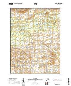
2019 Map of Iliamna B-6 SW
USGS Topo · Published 2019About this map
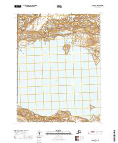
Katmai National Preserve encompasses the southern portion of this landscape, where the terrain transitions into a complex network of wetlands and small ponds. The topography is defined by the drainage of Belinda Cr, which meanders through the central-western section of the quadrangle. This area of Alaska’s Lake and Peninsula Borough remains largely undeveloped, characterized by its natural hydrological patterns and glacial landforms. The absence of roads or established settlements highlights the remote character of this sub-arctic environment, where township and range lines provide the only artificial structure to the map. For researchers, this survey provides a clear view of the untouched geography near the northern boundaries of the national preserve as it existed in the early twenty-first century.
Find a feature on this map
8 named features on this map. Tap any name to fly to it.
Don’t see what you’re looking for? This feature index may not catch every label — zoom into the map to look around manually.
Map Details
Editions of this 2019 Iliamna B-6 SW Map
This is the sole edition of this map. No revisions or reprints were ever made.
Other maps of this area

1951 · Iliamna A-7
USGS Topo · 1:63,360

1951 · Iliamna B-7
USGS Topo · 1:63,360

1951 · Iliamna B-6
USGS Topo · 1:63,360

1951 · Iliamna A-6
USGS Topo · 1:63,360

1952 · Iliamna
USGS Topo · 1:250,000
1954 · Iliamna B-6
USGS Topo · 1:63,360

1957 · Iliamna
USGS Topo · 1:250,000
2019 · Iliamna B-6 NW
USGS Topo · 1:25,000
2019 · Iliamna B-7 NE
USGS Topo · 1:25,000
2019 · Iliamna A-7 NE
USGS Topo · 1:25,000