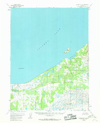
1951 Map of Iliamna B-7
USGS Topo · Published 1968About this map
Iliamna Lake dominates the northern landscape of this Alaskan interior quadrangle, where the water meets a low-lying shoreline marked by seasonal marshlands and braided drainage. In the early 1950s, travel through this region relied heavily on the Winter Trail cutting across the southwestern quadrant and a remote Landing Strip situated near the shore of Reindeer Bay. These transit markers point to a geography defined by seasonal accessibility and subsistence navigation, rather than permanent road infrastructure.
Find a feature on this map
12 named features on this map. Tap any name to fly to it.
Don’t see what you’re looking for? This feature index may not catch every label — zoom into the map to look around manually.
Map Details
Editions of this 1951 Iliamna B-7 Map
2 editions found
Other maps of this area

1951 · Iliamna A-7
USGS Topo · 1:63,360

1951 · Iliamna A-8
USGS Topo · 1:63,360

1951 · Iliamna B-7
USGS Topo · 1:63,360

1951 · Iliamna B-6
USGS Topo · 1:63,360

1951 · Iliamna A-6
USGS Topo · 1:63,360

1952 · Iliamna
USGS Topo · 1:250,000
1952 · Iliamna A-8
USGS Topo · 1:63,360

1954 · Iliamna C-6
USGS Topo · 1:63,360

1954 · Iliamna C-8
USGS Topo · 1:63,360
1954 · Iliamna B-6
USGS Topo · 1:63,360