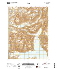
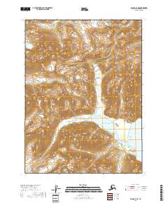
2018 Map of Iliamna C-2 NW
USGS Topo · Published 2018About this map
The Williamsport-Pile Bay Road provides a critical overland corridor through the mountainous terrain where the Chigmit Mountains and the Aleutian Range meet. This 2018 survey documents a remote coastal interface along the Pacific Ocean, where the deep indentations of Iliamna Bay and Cottonwood Bay reach inland toward the high country. Coastal landmarks such as Diamond Point and AC Point define the rugged shoreline, while the interior is marked by the high-elevation Summit Lakes and the drainage of Chinkelyes Cr. The topographic detail highlights the dramatic transition from sea level to the steep ridges of the Aleutian chain, illustrating the geographic constraints that dictated the path of the region's limited road infrastructure.
Find a feature on this map
15 named features on this map. Tap any name to fly to it.
Don’t see what you’re looking for? This feature index may not catch every label — zoom into the map to look around manually.
Map Details
Editions of this 2018 Iliamna C-2 NW Map
This is the sole edition of this map. No revisions or reprints were ever made.
Other maps of this area

1952 · Iliamna
USGS Topo · 1:250,000

1954 · Iliamna D-3
USGS Topo · 1:63,360

1954 · Iliamna C-3
USGS Topo · 1:63,360

1957 · Iliamna
USGS Topo · 1:250,000

1958 · Iliamna D-2
USGS Topo · 1:63,360

1958 · Iliamna C-2
USGS Topo · 1:63,360
2018 · Iliamna C-2 NE
USGS Topo · 1:25,000
2018 · Iliamna D-3 SE
USGS Topo · 1:25,000
2018 · Iliamna C-3 NE
USGS Topo · 1:25,000
2018 · Iliamna C-3 SE
USGS Topo · 1:25,000