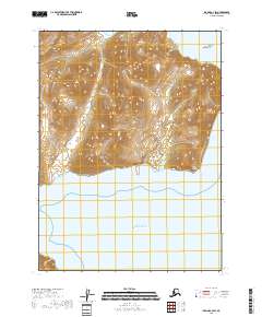
2018 Map of Iliamna C-2 SW
USGS Topo · Published 2018About this map
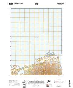
Brown Peak dominates the central landscape of this coastal survey, where the steep, high-elevation terrain of the Kenai Peninsula meets the Pacific Ocean. This area is defined by its dramatic transition from mountain summits to the saltwater inlets of the southern Alaskan coast. To the southeast, the prominent coastal feature of Ursus Head overlooks the waters, while Ursus Cove provides a sheltered break in the shoreline to the west. Just offshore, White Gull Island sits as a lonely landmark in the coastal waters. The 2018 data reflects a pristine and undeveloped wilderness, focused entirely on the natural hydrography and topographic relief of this maritime environment without any mapped road networks or human settlements.
Find a feature on this map
10 named features on this map. Tap any name to fly to it.
Don’t see what you’re looking for? This feature index may not catch every label — zoom into the map to look around manually.
Map Details
Editions of this 2018 Iliamna C-2 SW Map
This is the sole edition of this map. No revisions or reprints were ever made.
Other maps of this area

1952 · Iliamna
USGS Topo · 1:250,000

1954 · Iliamna C-3
USGS Topo · 1:63,360

1954 · Iliamna B-3
USGS Topo · 1:63,360

1957 · Iliamna
USGS Topo · 1:250,000

1958 · Iliamna C-2
USGS Topo · 1:63,360

1958 · Iliamna B-2
USGS Topo · 1:63,360
2018 · Iliamna C-2 NE
USGS Topo · 1:25,000
2018 · Iliamna B-2 NW
USGS Topo · 1:25,000
2018 · Iliamna C-3 NE
USGS Topo · 1:25,000
2018 · Iliamna B-2 NE
USGS Topo · 1:25,000