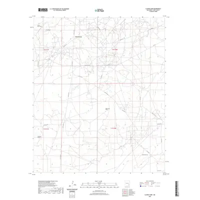
2020 Map of Illinois Camp
USGS Topo · Published 2020About this map
Illinois Camp sits at the heart of this Eddy County landscape, where the high desert terrain is defined by a dense network of local roads and named topographical features. The area's character is shaped by traditional ranching and petroleum industry routes, including the Hagerman Cutoff, Oil Center Rd, and the curiously named Cow Town Rd. The drainage patterns of the Pecos River valley are evident in the winding courses of Chalk Bluff Draw and Palmilla Draw, while the prominent Chalk Bluff and Fade Away Ridge provide significant elevation changes across the quadrangle. This 2020 survey captures the modern road grid, featuring labels such as Curry Comb Rd and Hillbilly Rd, which reflect the localized history and cultural naming conventions of this southeastern New Mexico region.
Find a feature on this map
25 named features on this map. Tap any name to fly to it.
Don’t see what you’re looking for? This feature index may not catch every label — zoom into the map to look around manually.
Map Details
Editions of this 2020 Illinois Camp Map
This is the sole edition of this map. No revisions or reprints were ever made.
Other maps of this area

1943 · Oil City
USGS Topo · 1:62,500

1954 · Carlsbad
USGS Topo · 1:250,000

1955 · Spring Lake
USGS Topo · 1:24,000

1955 · Red Lake SE
USGS Topo · 1:24,000

1955 · Lake Mc Millan North
USGS Topo · 1:24,000

1955 · Lake Mc Millan South
USGS Topo · 1:24,000

1955 · Red Lake
USGS Topo · 1:24,000

1958 · Carlsbad
USGS Topo · 1:250,000

1978 · Artesia
USGS Topo · 1:100,000
1985 · Angel Draw
USGS Topo · 1:24,000