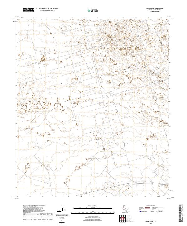
2022 Map of Imperial NW
USGS Topo · Published 2022About this map
Industrial infrastructure and ranching access dominate this corner of West Texas in Crane County. The presence of Pennzoil Loop and Exxon Loop signals the persistent role of the petroleum industry in shaping the local grid, while routes like Warren Plant Rd point toward specific processing or extraction sites. This desert landscape is further defined by its remote transportation network, including Sandhills Headquarters Rd and the long stretch of Ranch Rd 1233. Family-named landmarks such as Tubbs Rd and Jim Tubbs Rd offer a grounded look at the individuals who established themselves in this arid terrain, providing essential waypoints for genealogists and local historians tracing the development of Crane County’s rural interior.
Find a feature on this map
8 named features on this map. Tap any name to fly to it.
Don’t see what you’re looking for? This feature index may not catch every label — zoom into the map to look around manually.
Map Details
Editions of this 2022 Imperial NW Map
This is the sole edition of this map. No revisions or reprints were ever made.
Other maps of this area

1954 · Pecos
USGS Topo · 1:250,000

1957 · Pecos
USGS Topo · 1:250,000

1964 · Penwell SW
USGS Topo · 1:24,000

1964 · Penwell SE
USGS Topo · 1:24,000

1968 · Monahans SE
USGS Topo · 1:24,000

1969 · Ozark Lake
USGS Topo · 1:24,000

1969 · Grandfalls
USGS Topo · 1:24,000

1974 · Tubbs Corner
USGS Topo · 1:24,000

1974 · Juan Cordona Lake
USGS Topo · 1:24,000
1974 · Imperial NW
USGS Topo · 1:24,000