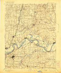
1894 Map of Independence
USGS Topo · Published 1921About this map
Independence and Liberty anchor this late 19th-century landscape where the Missouri River carves a winding path through the heart of the region. The map reveals a complex riverine environment, featuring large oxbow formations like Cooley Lake and Browns Lake, alongside river-dependent sites such as Liberty Landing and Liberty Island. This era was defined by a dense network of competing railroads that shaped local commerce, including the Santa Fe Railroad, Wabash Railroad, and the Missouri Pacific Railroad, which connected established hubs like Missouri City and Kearney to the wider territory. Smaller settlements such as Excelsior Springs, Sibley, and Orrick are clearly plotted, showing the early development of these communities before modern highway expansion altered the rural landscape.
Find a feature on this map
112 named features on this map. Tap any name to fly to it.
Don’t see what you’re looking for? This feature index may not catch every label — zoom into the map to look around manually.
Map Details
Editions of this 1894 Independence Map
5 editions found

Other maps of this area

1885 · Warrensburg
USGS Topo · 1:125,000

1887 · Harrisonville
USGS Topo · 1:125,000

1887 · Olathe
USGS Topo · 1:125,000

1887 · Warrensburg
USGS Topo · 1:125,000

1889 · Lexington
USGS Topo · 1:125,000

1890 · Kansas City
USGS Topo · 1:125,000

1892 · Harrisonville
USGS Topo · 1:125,000

1893 · Olathe
USGS Topo · 1:125,000

1894 · Kansas City
USGS Topo · 1:125,000

1894 · Harrisonville
USGS Topo · 1:125,000