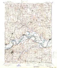
1894 Map of Independence
USGS Topo · Published 1941About this map
The Missouri River carves a sweeping path through this late 19th-century landscape, serving as the central artery for a region defined by its riverfront landings and growing rail hubs. Settlements like Liberty and Independence stand as established centers, while smaller river towns such as Missouri City and Sibley anchor the bluffs above the shifting currents. The map reveals an intricate network of waterways, including Cooley Lake and the meandering Crooked River, alongside early transport infrastructure like the Liberty Landing.
Find a feature on this map
102 named features on this map. Tap any name to fly to it.
Don’t see what you’re looking for? This feature index may not catch every label — zoom into the map to look around manually.
Map Details
Editions of this 1894 Independence Map
5 editions found

Other maps of this area

1885 · Warrensburg
USGS Topo · 1:125,000

1887 · Harrisonville
USGS Topo · 1:125,000

1887 · Olathe
USGS Topo · 1:125,000

1887 · Warrensburg
USGS Topo · 1:125,000

1889 · Lexington
USGS Topo · 1:125,000

1890 · Kansas City
USGS Topo · 1:125,000

1892 · Harrisonville
USGS Topo · 1:125,000

1893 · Olathe
USGS Topo · 1:125,000

1894 · Kansas City
USGS Topo · 1:125,000

1894 · Harrisonville
USGS Topo · 1:125,000