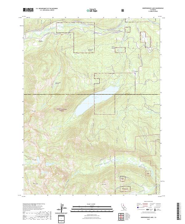
2021 Map of Independence Lake
USGS Topo · Published 2021About this map
Independence Lake sits as the central focal point of this high-altitude landscape along the border of Sierra Co and Nevada Co. The terrain is defined by a series of prominent peaks and ridgelines, including Mt Lola, Basin Peak, and Red Mtn, which frame various meadow systems such as Perazzo Meadows and Meathouse Meadow. The drainage patterns are clearly visible, with the Little Truckee River and Sagehen Cr flowing through the northern and eastern portions of the quadrangle.
Find a feature on this map
54 named features on this map. Tap any name to fly to it.
Don’t see what you’re looking for? This feature index may not catch every label — zoom into the map to look around manually.
Map Details
Editions of this 2021 Independence Lake Map
This is the sole edition of this map. No revisions or reprints were ever made.
Other maps of this area

1890 · Sierraville
USGS Topo · 1:125,000

1891 · Truckee
USGS Topo · 1:125,000

1892 · Sierraville
USGS Topo · 1:125,000

1893 · Truckee
USGS Topo · 1:125,000

1894 · Sierraville
USGS Topo · 1:125,000

1895 · Truckee
USGS Topo · 1:125,000

1932 · Truckee
USGS Topo · 1:96,000

1940 · Truckee
USGS Topo · 1:125,000

1955 · Truckee
USGS Topo · 1:24,000

1955 · Loyalton
USGS Topo · 1:62,500