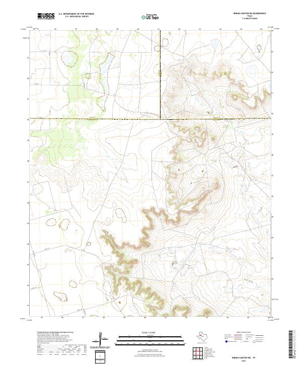
2022 Map of Indian Canyon NE
USGS Topo · Published 2022About this map
The intersection of Borden, Lynn, and Garza counties defines this high plains landscape, where the flat agricultural tableland drops suddenly into the carved drainages of the Llano Estacado. The upper reaches of Bull Cr cut deep, winding canyons through the eastern half of the map, revealing the complex topography that gives the Indian Canyon NE area its name. Further south, the broad, sandy bed of Salt Draw meanders toward the southeast, marking a significant hydrologic feature in this semi-arid region.
Find a feature on this map
16 named features on this map. Tap any name to fly to it.
Don’t see what you’re looking for? This feature index may not catch every label — zoom into the map to look around manually.
Map Details
Editions of this 2022 Indian Canyon NE Map
This is the sole edition of this map. No revisions or reprints were ever made.
Other maps of this area

1954 · Lubbock
USGS Topo · 1:250,000

1954 · Big Spring
USGS Topo · 1:250,000

1958 · Big Spring
USGS Topo · 1:250,000

1969 · Beal Hollow
USGS Topo · 1:24,000

1969 · Indian Canyon NE
USGS Topo · 1:24,000

1969 · Gail
USGS Topo · 1:24,000

1969 · Indian Canyon
USGS Topo · 1:24,000

1969 · Grassland SE
USGS Topo · 1:24,000
1969 · Middle Creek
USGS Topo · 1:24,000

1969 · Holloway Canyon
USGS Topo · 1:24,000