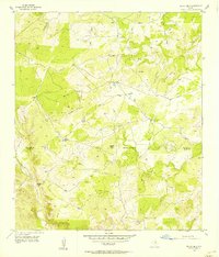
1956 Map of Indian Hills
USGS Topo · Published 1956About this map
Indian Hills and the surrounding rangeland on the border of San Saba and Llano counties are defined by a network of seasonal watercourses and upland peaks in the mid-1950s. The Little Llano River carves through the southwestern corner near Wilberns Glen, while the central landscape is dominated by elevations such as Bunker Hill and Marley Peaks. The area reflects a sparse, ranching-oriented settlement pattern, characterized by numerous named water-pumping landmarks like Jones Windmill, Javelina Windmill, and Big Windmill.
Find a feature on this map
20 named features on this map. Tap any name to fly to it.
Don’t see what you’re looking for? This feature index may not catch every label — zoom into the map to look around manually.
Map Details
Editions of this 1956 Indian Hills Map
This is the sole edition of this map. No revisions or reprints were ever made.
Other maps of this area

1885 · San Saba
USGS Topo · 1:125,000

1887 · Llano
USGS Topo · 1:125,000

1887 · Lampasas
USGS Topo · 1:125,000

1887 · Burnet
USGS Topo · 1:125,000

1893 · Burnet
USGS Topo · 1:125,000

1894 · Lampasas
USGS Topo · 1:125,000

1894 · San Saba
USGS Topo · 1:125,000

1894 · Llano
USGS Topo · 1:125,000

1903 · Burnet
USGS Topo · 1:125,000

1904 · Llano
USGS Topo · 1:125,000