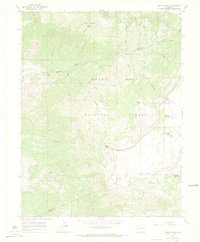
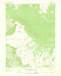
1965 Map of Indian Point
USGS Topo · Published 1968About this map
Grand Mesa National Forest dominates this mid-1960s landscape, where the plateau drops sharply toward the Mesa Co and Delta Co line. The terrain is defined by a series of dramatic volcanic points and basins, most notably Indian Point and the high Coal Creek Basin. A network of historic paths, including the Service Pack Trail and the Camp Spring Trail, crisscross the area, tracing routes once vital for forest management and local ranching. Water management is a central theme of the topography, evidenced by high-altitude catchments like Chambers Reservoir and Doughspoon Reservoir. Along Kannah Creek, a lone Gaging Sta stands as a reminder of early water measurement efforts in these headwaters. The map illustrates a transitional wilderness where primitive Jeep Trails begin to supplement the older pack routes used by early settlers and foresters.
Find a feature on this map
32 named features on this map. Tap any name to fly to it.
Don’t see what you’re looking for? This feature index may not catch every label — zoom into the map to look around manually.
Map Details
Editions of this 1965 Indian Point Map
4 editions found
Other maps of this area

1955 · Skyway
USGS Topo · 1:24,000

1956 · Moab
USGS Topo · 1:250,000

1956 · Grand Junction
USGS Topo · 1:250,000

1959 · Grand Junction
USGS Topo · 1:250,000

1959 · Moab
USGS Topo · 1:250,000

1960 · Moab
USGS Topo · 1:250,000

1960 · Grand Junction
USGS Topo · 1:250,000

1962 · Moab
USGS Topo · 1:250,000

1962 · Grand Junction
USGS Topo · 1:250,000
1962 · Lands End
USGS Topo · 1:24,000