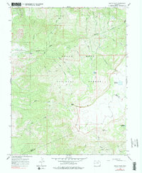
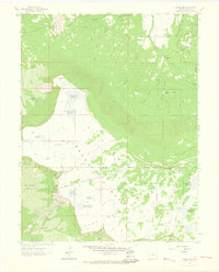
1965 Map of Indian Point
USGS Topo · Published 1978About this map
Grand Mesa dominates this landscape, rising above the surrounding valleys in the Grand Mesa National Forest. The 1965 survey reveals a high-altitude wilderness defined by its complex hydrology and the transition between the Mesa Co Delta Co boundary. The plateau is dotted with vital water management features like Chambers Reservoir and Doughspoon Reservoir, which serve as critical landmarks for the region's ranching and irrigation history.
Find a feature on this map
35 named features on this map. Tap any name to fly to it.
Don’t see what you’re looking for? This feature index may not catch every label — zoom into the map to look around manually.
Map Details
Editions of this 1965 Indian Point Map
4 editions found
Other maps of this area

1955 · Skyway
USGS Topo · 1:24,000

1956 · Moab
USGS Topo · 1:250,000

1956 · Grand Junction
USGS Topo · 1:250,000

1959 · Grand Junction
USGS Topo · 1:250,000

1959 · Moab
USGS Topo · 1:250,000

1960 · Moab
USGS Topo · 1:250,000

1960 · Grand Junction
USGS Topo · 1:250,000

1962 · Moab
USGS Topo · 1:250,000

1962 · Grand Junction
USGS Topo · 1:250,000
1962 · Lands End
USGS Topo · 1:24,000