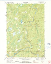
1971 Map of Ingram NE
USGS Topo · Published 1991About this map
The Flambeau River State Forest dominates this northern Wisconsin landscape, where the main channel and the South Fork Flambeau River converge amidst a dense network of water features. Navigational landmarks for river travel are meticulously noted, including a sequence of whitewater such as 1st Wannigan Rapids, 2d Wannigan Rapids, and Flambeau Falls Rapids. The terrain is shaped by its logging and transit history, evidenced by an Old Railroad Grade and the Winter Trail cutting through the timberland. Highlighting the recreational shift in the area, the map marks several Canoe Campsite locations and the Snowmobile Trail. Near the junction of the Sawyer and Rusk County line, the river widens around Dades Island, while smaller tributaries like Bear Creek and Thornapple River feed the primary watershed near Hegmeister Lake.
Find a feature on this map
34 named features on this map. Tap any name to fly to it.
Don’t see what you’re looking for? This feature index may not catch every label — zoom into the map to look around manually.
Map Details
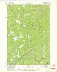
Editions of this 1971 Ingram NE Map
2 editions found
Other maps of this area

1941 · Kennan
USGS Topo · 1:48,000

1941 · Kennedy
USGS Topo · 1:48,000

1944 · Draper
USGS Topo · 1:48,000

1945 · Kennedy
USGS Topo · 1:48,000

1945 · Kennan
USGS Topo · 1:48,000

1945 · Ingram
USGS Topo · 1:48,000

1947 · Ingram
USGS Topo · 1:48,000

1947 · Draper
USGS Topo · 1:48,000

1953 · Rice Lake
USGS Topo · 1:250,000

1959 · Rice Lake
USGS Topo · 1:250,000