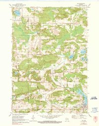
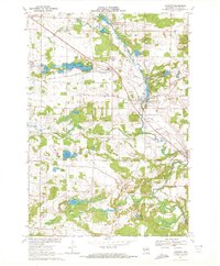
1971 Map of Iola
USGS Topo · Published 1990About this map
The village of Iola sits at the southern edge of this landscape, where the South Branch Little Wolf River feeds into Iola Lake. In the early 1970s, the surrounding countryside was characterized by a dense network of country roads named for local families, including Roosevelt Road and Peterson Road, and several small clusters of settlement like Northland and Peru. The topography is marked by numerous glacial lakes, such as Lake Helen, Graham Lake, and Siemer Lake, which dot the terrain between the primary drainages of Flume Creek and the Little Wolf River. Notable local landmarks and community sites are recorded across the quadrangle, including a Ski Jump located north of the main village and the Hitterdahl Cem near the eastern margin. Dozens of Gravel Pits are visible throughout the townships of Alban, Harrison, and Iola, indicating a landscape shaped by both natural waters and local industry.
Find a feature on this map
39 named features on this map. Tap any name to fly to it.
Don’t see what you’re looking for? This feature index may not catch every label — zoom into the map to look around manually.
Map Details
Editions of this 1971 Iola Map
2 editions found
Other maps of this area

1955 · Tigerton
USGS Topo · 1:48,000

1955 · Rosholt
USGS Topo · 1:48,000

1955 · Green Bay
USGS Topo · 1:250,000

1957 · Amherst
USGS Topo · 1:48,000

1957 · Waupaca
USGS Topo · 1:48,000

1969 · Rosholt
USGS Topo · 1:24,000
1969 · Ogdensburg
USGS Topo · 1:24,000

1969 · New Hope
USGS Topo · 1:24,000
1969 · Scandinavia
USGS Topo · 1:24,000
1969 · Amherst
USGS Topo · 1:24,000