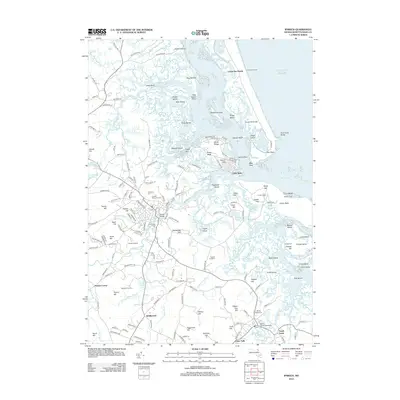
2012 Map of Ipswich
USGS Topo · Published 2012About this map
The coastal landscapes of Ipswich Bay and the Plum Island Sound define this 2012 survey, revealing a complex network of marshes, drumlins, and tidal creeks. The historic center of town is anchored by the Choate Bridge and several early burial grounds, including the Highland Cem and Old South Cem. Inland, the map illustrates the persistence of agricultural and open space through Appleton Farms and Russell Orchards, while the Snow Airport remains a notable landmark in the local aviation landscape.
Find a feature on this map
186 named features on this map. Tap any name to fly to it.
Don’t see what you’re looking for? This feature index may not catch every label — zoom into the map to look around manually.
Map Details
Editions of this 2012 Ipswich Map
This is the sole edition of this map. No revisions or reprints were ever made.
Other maps of this area

1886 · Gloucester
USGS Topo · 1:62,500

1888 · Newburyport
USGS Topo · 1:62,500

1888 · Gloucester
USGS Topo · 1:62,500

1888 · Salem
USGS Topo · 1:62,500

1890 · Newburyport
USGS Topo · 1:62,500

1893 · Salem
USGS Topo · 1:62,500

1893 · Gloucester
USGS Topo · 1:62,500

1894 · Newburyport
USGS Topo · 1:62,500

1917 · Salem
USGS Topo · 1:62,500

1918 · Gloucester
USGS Topo · 1:62,500