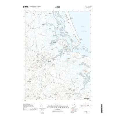
2018 Map of Ipswich
USGS Topo · Published 2018About this map
Ipswich serves as the focal point of this coastal survey, where the Ipswich River meets the complex marshlands of the Atlantic shore. The town's historical depth is visible through its concentration of burial grounds, including the Old South Cem and the Highland Cem near the town center. The landscape is defined by its glacial drumlins and coastal features, from the residential heights of Little Neck and Plover Hill to the significant landmarks of Castle Hill and the sweeping sands of Crane Beach. The intricate network of tidal creeks, such as Paine Creek and Nelson Island Creek, illustrates the tidewater geography that has shaped local life for centuries. Further north, the survey reaches toward Rowley, while to the southeast, the Essex River Causeway links the mainland to the marshes of Essex. This map provides a detailed view of the North Shore's topography, highlighting the preservation of coastal habitats alongside established colonial-era settlements.
Find a feature on this map
188 named features on this map. Tap any name to fly to it.
Don’t see what you’re looking for? This feature index may not catch every label — zoom into the map to look around manually.
Map Details
Editions of this 2018 Ipswich Map
This is the sole edition of this map. No revisions or reprints were ever made.
Other maps of this area

1886 · Gloucester
USGS Topo · 1:62,500

1888 · Newburyport
USGS Topo · 1:62,500

1888 · Gloucester
USGS Topo · 1:62,500

1888 · Salem
USGS Topo · 1:62,500

1890 · Newburyport
USGS Topo · 1:62,500

1893 · Salem
USGS Topo · 1:62,500

1893 · Gloucester
USGS Topo · 1:62,500

1894 · Newburyport
USGS Topo · 1:62,500

1917 · Salem
USGS Topo · 1:62,500

1918 · Gloucester
USGS Topo · 1:62,500