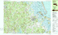
1985 Map of Ipswich
USGS Topo · Published 1986About this map
Ipswich and the coastal salt marshes of the Parker River National Wildlife Refuge define this North Shore landscape during the mid-1980s. The map illustrates a complex coastal geography where Plum Island Sound separates the mainland from Plum Island State Park and the extensive Castle Neck River estuary. Inland, the topography is dotted with glacial drumlins and hills such as Hunsley Hills and Bartholomew Hill, while the Ipswich River meanders through the Willowdale State Forest.
Find a feature on this map
166 named features on this map. Tap any name to fly to it.
Don’t see what you’re looking for? This feature index may not catch every label — zoom into the map to look around manually.
Map Details
Editions of this 1985 Ipswich Map
3 editions found
Other maps of this area

1886 · Gloucester
USGS Topo · 1:62,500

1886 · Lawrence
USGS Topo · 1:62,500

1888 · Newburyport
USGS Topo · 1:62,500

1888 · Haverhill
USGS Topo · 1:62,500

1888 · Gloucester
USGS Topo · 1:62,500

1888 · Lawrence
USGS Topo · 1:62,500

1888 · Salem
USGS Topo · 1:62,500

1890 · Haverhill
USGS Topo · 1:62,500

1890 · Newburyport
USGS Topo · 1:62,500

1893 · Salem
USGS Topo · 1:62,500