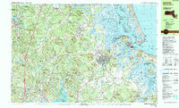
1985 Map of Ipswich
USGS Topo · Published 1986About this map
Ipswich and its surrounding salt marshes define this coastal landscape, where the Ipswich River meets the Plum Island Sound. The area is characterized by a complex network of glacial drumlins and tidal estuaries, including Eagle Hill River and the expansive Plum Island National Wildlife Refuge. Inland, the terrain rises into the Hunsley Hills and is heavily forested within the Willowdale State Forest and Georgetown-Rowley State Forest. The map captures the region's long-established educational and religious institutional presence, featuring the Governor Dummer Academy and Sacred Heart Juniorate. Transportation is anchored by the Boston and Maine railroad corridor, while unique scientific infrastructure like the USAF Geophysics Lab Radio Observatory sits near South Essex. Smaller crossroads like Linebrook and Kinsman Corner offer a look at the inland settlement pattern before later suburban expansion.
Find a feature on this map
162 named features on this map. Tap any name to fly to it.
Don’t see what you’re looking for? This feature index may not catch every label — zoom into the map to look around manually.
Map Details
Editions of this 1985 Ipswich Map
3 editions found
Other maps of this area

1886 · Gloucester
USGS Topo · 1:62,500

1886 · Lawrence
USGS Topo · 1:62,500

1888 · Newburyport
USGS Topo · 1:62,500

1888 · Haverhill
USGS Topo · 1:62,500

1888 · Gloucester
USGS Topo · 1:62,500

1888 · Lawrence
USGS Topo · 1:62,500

1888 · Salem
USGS Topo · 1:62,500

1890 · Haverhill
USGS Topo · 1:62,500

1890 · Newburyport
USGS Topo · 1:62,500

1893 · Salem
USGS Topo · 1:62,500