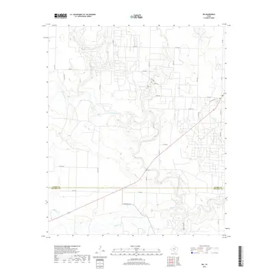
2019 Map of Ira
USGS Topo · Published 2019About this map
The community of Ira anchors this West Texas landscape where the high plains meet the winding course of the Colorado River. This 2019 survey documents a rural environment defined by a dense network of county roads and ranching routes, including Ranch Rd 1229 and Ira School Rd. Water is the primary architect of the terrain here; the river is joined by numerous tributaries such as Bull Creek, Bluff Cr, and Willow Cr that carve deep into the land, most notably at Cedar Canyon. This drainage system illustrates the erosion patterns characteristic of the region's ranchlands. For those tracing local heritage, the Bluff Creek Cem remains a significant landmark north of the river, while the crossing of the Scurry Co and Mitchell Co line provides a clear boundary for regional genealogical and land-use research.
Find a feature on this map
36 named features on this map. Tap any name to fly to it.
Don’t see what you’re looking for? This feature index may not catch every label — zoom into the map to look around manually.
Map Details
Editions of this 2019 Ira Map
This is the sole edition of this map. No revisions or reprints were ever made.
Other maps of this area

1950 · Cedar Bend
USGS Topo · 1:24,000

1951 · Ira SW
USGS Topo · 1:24,000

1951 · Ira
USGS Topo · 1:24,000

1951 · Dunn
USGS Topo · 1:24,000

1951 · Ira NW
USGS Topo · 1:24,000

1951 · Vincent
USGS Topo · 1:24,000

1952 · Cuthbert
USGS Topo · 1:24,000

1952 · Snyder
USGS Topo · 1:24,000

1952 · Ira NE
USGS Topo · 1:24,000

1954 · Big Spring
USGS Topo · 1:250,000