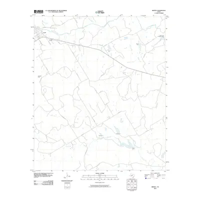
2010 Map of Iredell
USGS Topo · Published 2010About this map
Iredell sits along the northern banks of the North Bosque River, serving as a central hub for the surrounding ranching and agricultural landscape in this 2010 survey. The terrain is defined by its water management, evidenced by numerous small-scale reservoirs like Beard Dam, Reed Dam 1, and Farrell Lake Number 1 Dam that dot the tributaries feeding the main river. To the southwest, Johnson Peak rises as a prominent landmark above the winding path of Spring Creek. For local historians and genealogists, the New Iredell Cemetery is a significant site, positioned just south of the town center near the intersection of several county roads. The map captures a detailed network of rural routes, such as Spring Creek Rd and Farm Rd 927, which provide access to the various branches and creeks that drain this part of the Bosque River valley.
Find a feature on this map
31 named features on this map. Tap any name to fly to it.
Don’t see what you’re looking for? This feature index may not catch every label — zoom into the map to look around manually.
Map Details
Editions of this 2010 Iredell Map
This is the sole edition of this map. No revisions or reprints were ever made.
Other maps of this area

1888 · Meridian
USGS Topo · 1:125,000

1889 · Granbury
USGS Topo · 1:125,000

1894 · Meridian
USGS Topo · 1:125,000

1931 · Morgan
USGS Topo · 1:62,500

1954 · Dallas
USGS Topo · 1:250,000

1954 · Waco
USGS Topo · 1:250,000

1955 · Waco
USGS Topo · 1:250,000

1955 · Meridian
USGS Topo · 1:24,000

1956 · Cranfills Gap
USGS Topo · 1:24,000
1956 · Fairy
USGS Topo · 1:24,000