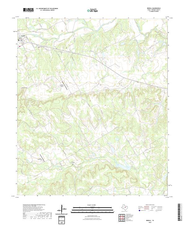
2022 Map of Iredell
USGS Topo · Published 2022About this map
Iredell sits at the northern edge of this Bosque County landscape, where the North Bosque River winds through the valley floor. The settlement's history is anchored by Riverside Cem near the riverbanks and Mitchell Cem to the east along Co Rd 2141. The terrain is defined by dramatic elevation changes, notably at Johnson Peak, which rises above a network of drainages including Spring Creek and Walker Br.
Find a feature on this map
44 named features on this map. Tap any name to fly to it.
Don’t see what you’re looking for? This feature index may not catch every label — zoom into the map to look around manually.
Map Details
Editions of this 2022 Iredell Map
This is the sole edition of this map. No revisions or reprints were ever made.
Other maps of this area

1888 · Meridian
USGS Topo · 1:125,000

1889 · Granbury
USGS Topo · 1:125,000

1894 · Meridian
USGS Topo · 1:125,000

1931 · Morgan
USGS Topo · 1:62,500

1954 · Dallas
USGS Topo · 1:250,000

1954 · Waco
USGS Topo · 1:250,000

1955 · Waco
USGS Topo · 1:250,000

1955 · Meridian
USGS Topo · 1:24,000

1956 · Cranfills Gap
USGS Topo · 1:24,000
1956 · Fairy
USGS Topo · 1:24,000