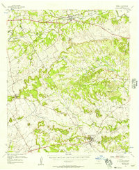
1956 Map of Iredell
USGS Topo · Published 1957About this map
The Bosque River meanders across the northern reaches of this mid-century survey, defining the valley where the town of Iredell and the Missouri Kansas Texas railroad established a footing. This area on the Hamilton and Bosque County line is a landscape of distinct limestone mesas and ridges, featuring prominent landmarks like Johnson Peak, Spencer Mountain, and Flat Top Mountain.
Find a feature on this map
54 named features on this map. Tap any name to fly to it.
Don’t see what you’re looking for? This feature index may not catch every label — zoom into the map to look around manually.
Map Details
Editions of this 1956 Iredell Map
This is the sole edition of this map. No revisions or reprints were ever made.
Other maps of this area

1888 · Hamilton
USGS Topo · 1:125,000

1888 · Meridian
USGS Topo · 1:125,000

1889 · Granbury
USGS Topo · 1:125,000

1890 · Stephenville
USGS Topo · 1:125,000

1894 · Hamilton
USGS Topo · 1:125,000

1894 · Meridian
USGS Topo · 1:125,000

1920 · Stephenville
USGS Topo · 1:125,000

1931 · Morgan
USGS Topo · 1:62,500

1954 · Brownwood
USGS Topo · 1:250,000

1954 · Dallas
USGS Topo · 1:250,000