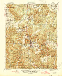
1946 Map of Ironton
USGS Topo · Published 1946About this map
The Missouri Pacific railroad carves through the heart of the St. Francois Mountains, connecting the high-elevation iron mining district at Iron Mountain with the valley settlements of Ironton and Arcadia. This mid-century survey reveals a landscape where the industrial heritage of the Ozark Ore Co Lake meets the spiritual and civic life of the Arcadia Bible Camp and the County Farm. To the west, the summit of Taum Sauk Mountain anchors the terrain, while landmarks like Devils Toll Gate and the Buck Mountain Fire Tower stand as distinctive navigational points in the heavily wooded hills.
Find a feature on this map
104 named features on this map. Tap any name to fly to it.
Don’t see what you’re looking for? This feature index may not catch every label — zoom into the map to look around manually.
Map Details
Editions of this 1946 Ironton Map
2 editions found

Other maps of this area

1904 · Farmington
USGS Topo · 1:62,500

1905 · Bonneterre
USGS Topo · 1:62,500

1906 · Potosi
USGS Topo · 1:62,500

1906 · Farmington
USGS Topo · 1:62,500

1924 · Edgehill
USGS Topo · 1:62,500

1926 · Edgehill
USGS Topo · 1:62,500

1926 · Des Arc
USGS Topo · 1:62,500

1929 · Des Arc
USGS Topo · 1:62,500

1930 · Coldwater
USGS Topo · 1:62,500

1937 · Ironton
USGS Topo · 1:48,000