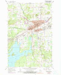
1955 Map of Ironwood
USGS Topo · Published 1977About this map
The Montreal River carves the border between Michigan and Wisconsin in this mid-century topographic study, anchoring the twin mining and timber hubs of Ironwood and Hurley. The map details a landscape deeply influenced by industrial geology, featuring several large sunken areas and the Cary Mine situated near Germania. These depressions and workings reflect the extensive underground iron mining legacy of the Gogebic Range. Cultural life is well-documented through local institutions such as Murphy High Sch, Central Sch, and the Finnish Ch in the settlement of Erwi.
Find a feature on this map
51 named features on this map. Tap any name to fly to it.
Don’t see what you’re looking for? This feature index may not catch every label — zoom into the map to look around manually.
Map Details
Editions of this 1955 Ironwood Map
5 editions found
Other maps of this area

1940 · Upson
USGS Topo · 1:48,000

1943 · Little Girls Point
USGS Topo · 1:24,000

1943 · Upson
USGS Topo · 1:48,000

1943 · Ironwood
USGS Topo · 1:48,000

1943 · Little Girl Point
USGS Topo · 1:48,000

1953 · Ashland
USGS Topo · 1:250,000

1955 · Ironwood
USGS Topo · 1:24,000

1955 · Bessemer
USGS Topo · 1:24,000

1955 · Ironwood
USGS Topo · 1:62,500

1956 · North Ironwood
USGS Topo · 1:62,500