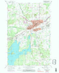
1955 Map of Ironwood
USGS Topo · Published 1997About this map
The Montreal River defines the rugged border between Michigan and Wisconsin, separating the industrial centers of Ironwood and Hurley. This mid-century survey captures the region's deep mining heritage, evidenced by the Cary Mine and numerous unnamed mine dumps and gravel pits scattered across the landscape. The urban centers are dense with social and civic infrastructure, from the Murphy High Sch and Sleight Sch to the local Armory and City Hall.
Find a feature on this map
65 named features on this map. Tap any name to fly to it.
Don’t see what you’re looking for? This feature index may not catch every label — zoom into the map to look around manually.
Map Details
Editions of this 1955 Ironwood Map
5 editions found
Other maps of this area

1940 · Upson
USGS Topo · 1:48,000

1943 · Little Girls Point
USGS Topo · 1:24,000

1943 · Upson
USGS Topo · 1:48,000

1943 · Ironwood
USGS Topo · 1:48,000

1943 · Little Girl Point
USGS Topo · 1:48,000

1953 · Ashland
USGS Topo · 1:250,000

1955 · Ironwood
USGS Topo · 1:24,000

1955 · Bessemer
USGS Topo · 1:24,000

1955 · Ironwood
USGS Topo · 1:62,500

1956 · North Ironwood
USGS Topo · 1:62,500