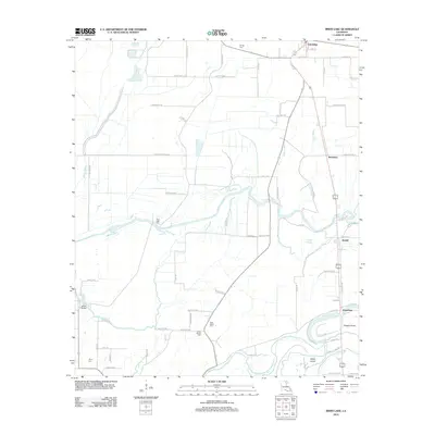
2012 Map of Irwin Lake
USGS Topo · Published 2012About this map
Oak Ridge anchors the northern reaches of this Morehouse Parish landscape, where the agricultural flats are intricately carved by a network of bayous and sloughs. The meandering course of Bayou Lafourche and the Boeuf River define the local drainage, creating natural boundaries for the surrounding farmland. This 2012 survey illustrates the persistence of rural communities like Bordenax, Bardel, and Jonesburg, which are linked by a grid of parish roads often named for local families and landmarks, such as Sam Smith Ln and George Franklin Rd.
Find a feature on this map
74 named features on this map. Tap any name to fly to it.
Don’t see what you’re looking for? This feature index may not catch every label — zoom into the map to look around manually.
Map Details
Editions of this 2012 Irwin Lake Map
This is the sole edition of this map. No revisions or reprints were ever made.
Other maps of this area

1935 · Collinston
USGS Topo · 1:62,500

1935 · Alto
USGS Topo · 1:62,500

1935 · Baskinton
USGS Topo · 1:62,500

1935 · Hurricane
USGS Topo · 1:62,500

1955 · Jackson
USGS Topo · 1:250,000

1957 · Mangham
USGS Topo · 1:62,500

1957 · Collinston
USGS Topo · 1:62,500

1958 · Baskinton
USGS Topo · 1:62,500

1958 · Hurricane
USGS Topo · 1:62,500

1961 · Jackson
USGS Topo · 1:250,000