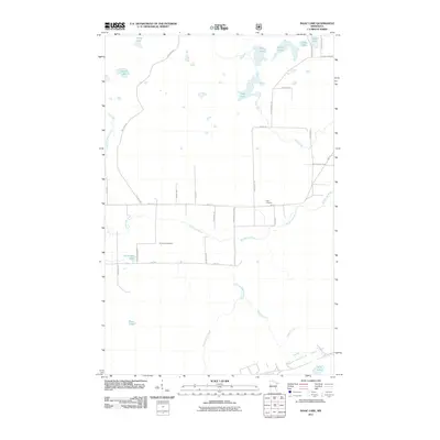
2011 Map of Isaac Lake
USGS Topo · Published 2011About this map
Armanda Cemetery and Argo Cemetery serve as important local landmarks in this corner of the Iron Range, where the landscape is defined by its complex network of glacial lakes and slow-moving waterways. The Embarrass River meanders across the central terrain, joined by smaller tributaries like Spring Mine Creek and Ridge Creek. To the north, the terrain transitions into a dense collection of water bodies, including Isaac Lake, Arthur Lake, and Sock Lake, many of which feed into the Birch River. The road network follows a distinctive grid pattern of named rural routes, including Pulkanen Rd, Salo Rd, and Mattson Rd, reflecting the heritage of the settlers who established homesteads and timber operations in this part of Saint Louis County.
Find a feature on this map
35 named features on this map. Tap any name to fly to it.
Don’t see what you’re looking for? This feature index may not catch every label — zoom into the map to look around manually.
Map Details
Editions of this 2011 Isaac Lake Map
This is the sole edition of this map. No revisions or reprints were ever made.
Other maps of this area

1933 · Ely
USGS Topo · 1:62,500

1939 · Ely
USGS Topo · 1:62,500

1949 · Aurora
USGS Topo · 1:24,000

1949 · Isaac Lake
USGS Topo · 1:24,000

1949 · Allen
USGS Topo · 1:24,000

1949 · Embarrass
USGS Topo · 1:24,000

1950 · Isaac Lake
USGS Topo · 1:24,000

1950 · Embarrass
USGS Topo · 1:24,000

1950 · Allen
USGS Topo · 1:24,000

1950 · Aurora
USGS Topo · 1:24,000