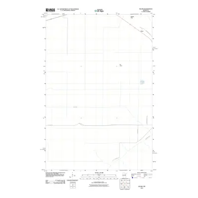
2010 Map of Island
USGS Topo · Published 2010About this map
Island and Hartley Spur sit at the intersection of rail and road networks in this corner of Saint Louis County during the early 21st century. The landscape is defined by the drainage patterns of the East Savanna River and Sixteen Creek, which weave through a predominantly rural and open terrain. Evidence of local settlement and land use is found along established routes like Floodwood Rd and Saint Vincent Rd, which connect the small clusters of activity at Big Island. This 2010 survey reflects a period where the primary infrastructure consists of these named county roads and the rail line passing through the northeastern corner. Smaller water bodies like Potshot Lake provide focal points within the topographic relief, while named local paths such as Laurie Rd and Robinson Rd offer specific identifiers for genealogists and local historians tracking property boundaries and rural residency in this portion of the Minnesota Northwoods.
Find a feature on this map
12 named features on this map. Tap any name to fly to it.
Don’t see what you’re looking for? This feature index may not catch every label — zoom into the map to look around manually.
Map Details
Editions of this 2010 Island Map
This is the sole edition of this map. No revisions or reprints were ever made.
Other maps of this area

1953 · Duluth
USGS Topo · 1:250,000

1954 · Hibbing
USGS Topo · 1:250,000

1957 · Hibbing
USGS Topo · 1:250,000

1958 · Hibbing
USGS Topo · 1:250,000

1958 · Duluth
USGS Topo · 1:250,000

1963 · Prairie Lake
USGS Topo · 1:24,000

1963 · Toivola SW
USGS Topo · 1:24,000
1963 · Floodwood
USGS Topo · 1:24,000

1964 · Hibbing
USGS Topo · 1:250,000

1969 · Wawina
USGS Topo · 1:24,000