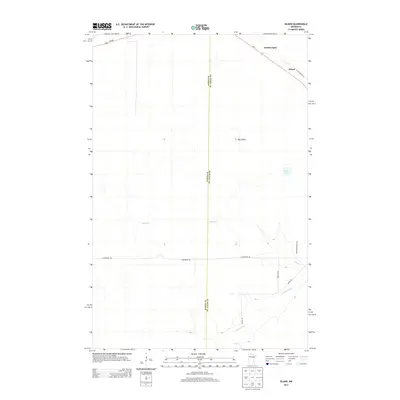
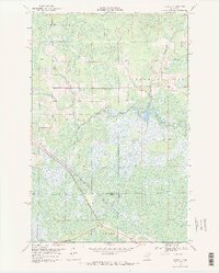
2013 Map of Island
USGS Topo · Published 2013About this map
Island and the railway-adjacent Hartley Spur sit near the northeastern corner of this landscape, where the Aitkin and St. Louis county line bisects a terrain of wetlands and slow-moving water. The hydrological network is defined by the winding course of Sixteen Cr and the E Savanna River, which drain toward the south. Amidst the low-lying reaches, Big Island rises as a distinct topographic feature, while Potshot Lake provides a localized landmark for those navigating the backcountry. Rural thoroughfares such as Floodwood Rd and Saint Vincent Rd create a grid of access across the region, supporting the remote timber and transit economy of this section of Northern Minnesota. This 2013 survey provides a clear view of the modern road network, including Us-2 and MN-200, as they intersect this quiet stretch of the North Woods.
Find a feature on this map
14 named features on this map. Tap any name to fly to it.
Don’t see what you’re looking for? This feature index may not catch every label — zoom into the map to look around manually.
Map Details
Editions of this 2013 Island Map
This is the sole edition of this map. No revisions or reprints were ever made.
Other maps of this area

1953 · Duluth
USGS Topo · 1:250,000

1954 · Hibbing
USGS Topo · 1:250,000

1957 · Hibbing
USGS Topo · 1:250,000

1958 · Hibbing
USGS Topo · 1:250,000

1958 · Duluth
USGS Topo · 1:250,000
1963 · Prairie Lake
USGS Topo · 1:24,000
1963 · Toivola SW
USGS Topo · 1:24,000
1963 · Floodwood
USGS Topo · 1:24,000

1964 · Hibbing
USGS Topo · 1:250,000
1969 · Wawina
USGS Topo · 1:24,000